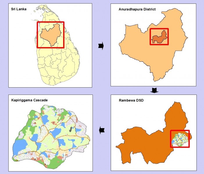
Kapiriggama Cascade
Kapiriggama cascade is located in the Malwathu Oya basin. It comprises of 21 small irrigation tanks and one medium irrigation tank, the Kapiriggama tank.
The Kapiriggama cascade comes under the DL1b agro-ecological zone. It has a bi-modal rainfall pattern with distinct rainfall peaks from March to May and October to December. The average annual rainfall in DL1b agro-ecological zone is above 900 mm.
The Kapiriggama cascade is located in the Rambewa Divisional Secretariat of Anuradhapura District. The cascade is comprised of three Grama Niladhari Divisions, namely Kapiriggama, Peenagama, and Konakumbukwewa. The total irrigable area of the cascade is about 500 ha. In 2013 there were 594 households in the cascade area.
Details of Irrigation Structures within the Kapiriggama Cascade
| Tank locations | Tank Name | Number of Families | Area Cultivable reported in 2013 (acres) | Area under paddy (acres) (from 2007 to 2011) | |
|---|---|---|---|---|---|
| Maha | Yala | ||||
| Peenagama | Peenagama-Mahawewa | 85 | 131.0 | 90.2 | 27.2 |
| Massalawa | 35 | 51.5 | 64.2 | 18.4 | |
| Aluthgama Wewa | 30 | 48.0 | 46.3 | 16.2 | |
| Aluwaketuwala Wewa | 40 | 43.0 | DNA | DNA | |
| Peenagama-Kudawewa | 45 | 38.0 | 36.7 | 8.6 | |
| Kuda Kadiyawa | 11 | 21.5 | 16.6 | 0 | |
| Kikligewewa | 11 | 15.5 | 12.2 | 0 | |
| Kayangollewa | 5 | 13.5 | 14.8 | 0 | |
| Konakumbukwewa | Konakumbukwewa | 38 | 105.0 | 146.5 | 53 |
| Galkadawala wewa | 40 | 85.0 | 69.5 | 43.8 | |
| Maha Kadiyawa wewa | 48 | 85.0 | 37.5 | 14.4 | |
| Mailagammana maha wewa | 45 | 53.5 | 36.4 | 12.4 | |
| Puliyankulama wewa | 34 | 36.5 | 27.4 | 9 | |
| Karuwalagaswewa | 30 | 22.0 | 15.5 | 0 | |
| Kohombagaswewa | 20 | 16.5 | 14.4 | 0 | |
| Palugonamariyawa wewa | 12 | 16.0 | 9.2 | 3 | |
| Wanniyankulama | 3 | 12.0 | 6 | 0 | |
| Galkadawala Kayanwewa | 3 | 11.0 | 5.4 | 0 | |
| Palugaswewa | 3 | 9.0 | DNA | DNA | |
| Mailagammana Kudawewa | 7 | 8.5 | 5 | 1 | |
| Kapiriggama | Kapiriggama wewa | 178 (including the small communities of small tanks downstream of Kapiriggama tank) | 360.0 | DNA | DNA |
DNA – Data not available